-
World Wide Maps Count Superbush Bush Walks Map
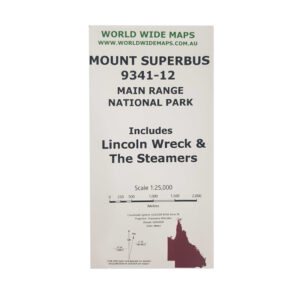
Accessories, Navigation, World Wide Maps$ 25.50Mount Superbus, the Steamers, the Lincoln Wreck and north to Mount Huntley.This map is a full size A1 topographic map at 1:25,000 standard map number 9341-12. Includes information about some walks and camp sites and how to get there. -
World Wide Maps Cunninghams Gap Bush Walks – Main Range
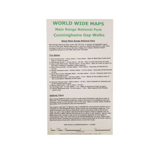
Accessories, Navigation, World Wide Maps$ 25.50- Box Forest track - Rainforest circuit - Gap Creek Falls track - Palm Grove circuit - Mount Cordeaux track - Bare Rock track/ Morgans Walk - Mount Mitchell track - Pioneer Graves track - Moss's Well track - Heritage trail - Mount Mathieson trail The map comes as compact shirt pocket sized (A3) double sided and folded topographic maps of the Cunninghams Gap–Main Range National Park area. The maps display the best available contours, tracks and the latest topographic information. The reverse side is a general location topo/road map and the map includes general instructions on how to get to the area. The map data is sourced from the latest Queensland Government topographic datasets through QTopo and the Government's Open Data Strategy.1:18,000 scale topographic map of Cunninghams Gap and Main Range bush walking tracks:
-
World Wide Maps Cunninghams Gap to Wilsons Peak Map
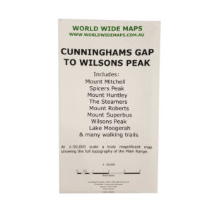
Accessories, Navigation, World Wide Maps$ 25.50One great topographic map at 1:50,000 scale showing the whole Main Range from Cunninghams Gap to Wilsons Peak.Includes Mount Mitchell, Mount Huntley, The Steamers, Mount Superbus and Lake Moogerah. -
World Wide Maps Hinchinbrookk Island – Thorsborne Trail 1:50000 Scale
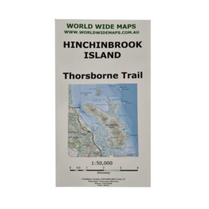
Accessories, Navigation, World Wide Maps$ 25.50And covering most of the rest of the island except the North East and North West points. The map has the camping sites and toilets marked and information about the walk, as well as link to national parks website for further information.An A1 size folded paper topographic map at 1:50,000 scale covering the entire Thorsborne Trail on Hinchinbrook Island.
-

World Wide Maps Lost World and Stinson Wreck Map
Accessories, Navigation, World Wide Maps$ 25.501:25,000 scale and full sized topo map for bush walking to both the Stinson Wreck and Lost World and the areas between them.All on one map sheet. -
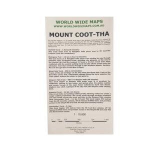
World Wide Maps Mount Coot-Tha Map
Accessories, Navigation, World Wide Maps$ 25.50A full size (A1) topographic map at 1:10,000 scale of Mount Coot-tha Brisbane.Information about the walks and the trails marked. -
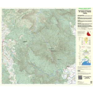
World Wide Maps Mt. Bargle Frere Trail Map
Accessories, Navigation, World Wide MapsA full sized 1:36,000 scale topographic map of Mount Bartle Frere Trail showing the trail, information about the trail and how to get there, camp sites, and all of the normal topographic features. Climb Queensland's highest mountain with the best map for it ever published!$ 25.50 -
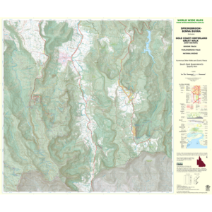
World Wide Maps Springbrook Binna Burra Topographic Map
Accessories, Navigation, World Wide MapsTopographic Map (A1 size) Springbrook to Binna Burra Great Walk—Showing walking tracks including the Great Walk between Springbrook and Binna Burra on the scenic rim in the Gold Coast Hinterland, South East Queensland. 1:25,000 scale.$ 25.50 -
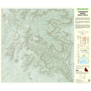
World Wide Maps Carnarvon Gorge Great Walk Map
Accessories, Navigation, World Wide Maps$ 25.50Full size (A1) topographic map at 1:50,000 scale of the entire Carnarvon Great Walk.This is the best traditional topographic map of the Great Walk and the topography of the gorge and tablelands. -

World Wide Maps Girraween Camps & Walks Map
Accessories, Navigation, World Wide Maps$ 25.50Derived from the latest government databases with information about walks, camping and caravan information and links to book your campsite. This map is intended to replace the Hema Girraween map and the government Girraween topo, which are both no longer in production.World Wide Maps have produced a 1:25,000 scale full size topographic map
-
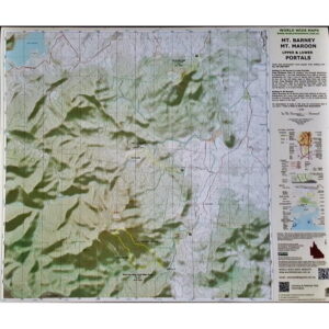
World Wide Maps Mt. Barney Mt. Maroon Upper & Lower Portals Map
Accessories, Navigation, World Wide Maps$ 25.50Key walks marked with short descriptions and advice on how to get there. This is a full sized (A1) 1:25000 scale topographic map with 3 of South East Queensland's most popular walking areas all on one topo map. This is the SEQ bushwalker's must have map! There are numerous walks contained within this topographic map area.Mount Barney, Mount Maroon and Upper and Lower Portals all on one topographic map!
-
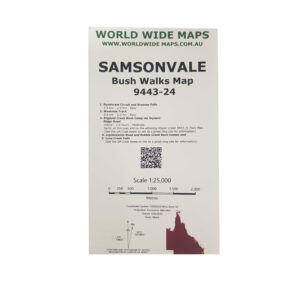
World Wide Maps Samsonvale Bush Walks Map 9443-24
Accessories, Navigation, World Wide Maps$ 25.50This print on demand 1:25,000 scale topo map Samsonvale 9443-24, replaces the old published map (1981).The standard topo map has been enhanced by World Wide Maps with 5 bush walks highlighted. 1. Rainforest Circuit and Greenes Falls 2. Westside Track 3. England Creek Bush Camp via Joyners Ridge Road 4. Lepidozamia Road and Kobble Creek Bush Camps 5. Love Creek Falls The map covers part of South D'aguilar National Park, Brisbane Forest Park. -
Sold out
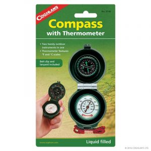
COGHLAN’S COMPASS THERMOMETER
Accessories, Coghlan's, Navigation, Outdoor & Trekking$ 19.95Two handy outdoor instruments in one. Liquid filled compass with luminous dial. “Homefinder” instructions on package. Thermometer features °F and °C scales. Belt clip and lanyard included. -
Sold out
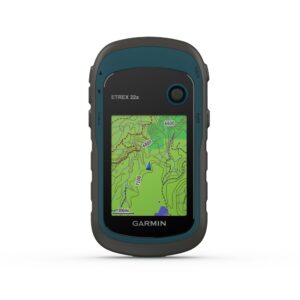
Garmin eTrex 22x
Accessories, Garmin, Navigation, Watch / GPSExplore Confidently with the Reliable Handheld GPS. - 2.2" sunlight-readable color display with 240 x 320 display pixels for improved readability - Preloaded with TopoActive maps with routable roads and trails for cycling and hiking - Support for GPS and GLONASS satellite systems allows for tracking in more challenging environments than GPS alone - 8 GB of internal memory plus a microSD card slot - eTrex 32x adds a 3-axis compass and barometric altimeter - Battery life: up to 25 hours in GPS mode with 2 AA batteries eTrex 22x and eTrex 32x offer the same ease-of-use, durability and affordability that the eTrex handheld GPS series is known for—along with preloaded TopoActive maps. These devices are perfect for ATVs, bicycles, boats or hiking. See the Way eTrex 22x and 32x offer enhanced 2.2", 65K color, sunlight-readable displays. Durable and water resistant, these handhelds are built to withstand the elements. Explore the Terrain The eTrex 22x and 32x handheld devices come preloaded with road-routable TopoActive maps that feature streets and trails so you can take the journey off the grid. Now you can know your surroundings—such as waterways, natural features as well as buildings, international boundaries and more. You can also find thousands of points of interests, including shops, restaurants, universities, car parks and accommodations. Keep Your Fix The eTrex series uses both GPS and GLONASS satellite systems so the receiver has the ability to track in more challenging environments than GPS alone. eTrex 32x adds a 3-axis compass and barometric altimeter, making it easy for you to keep your bearings. Satellite Imagery Both devices support BirdsEye Satellite Imagery (subscription required), so you can download and integrate satellite imagery with your maps. Find Fun eTrex 22x and eTrex 32x support paperless geocaching. Upload GPX files straight to your device, and view key information such as location, terrain and hints from Geocaching.com Go Anywhere With an array of compatible mounts, eTrex is designed as a handheld—for use on ATVs or bicycles, in boats or on foot. Use the auto mount capability and City Navigator NT maps for turn-by-turn driving directions, or use the rugged mount for your motorcycle or ATV. Wherever you think you might take eTrex, it has the mapping and mounts to get you there.$ 339.00 -
Sold out
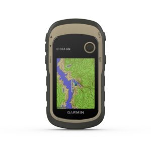
Garmin eTrex 32x
Accessories, Garmin, Navigation, Watch / GPS$ 529.00Explore Confidently with the Reliable Handheld GPS- 2.2" sunlight-readable color display with 240 x 320 display pixels for improved readability - Preloaded with TopoActive maps with routable roads and trails for cycling and hiking - Support for GPS and GLONASS satellite systems allows for tracking in more challenging environments than GPS alone - 8 GB of internal memory plus a microSD card slot - eTrex 32x adds a 3-axis compass and barometric altimeter - Battery life: up to 25 hours in GPS mode with 2 AA batteries eTrex 22x and eTrex 32x offer the same ease-of-use, durability and affordability that the eTrex handheld GPS series is known for along with preloaded TopoActive maps. These devices are perfect for ATVs, bicycles, boats or hiking. See the Way eTrex 22x and 32x offer enhanced 2.2", 65K color, sunlight-readable displays. Durable and water resistant, these handhelds are built to withstand the elements. Explore the Terrain The eTrex 22x and 32x handheld devices come preloaded with road-routable TopoActive maps that feature streets and trails so you can take the journey off the grid. Now you can know your surroundings—such as waterways, natural features as well as buildings, international boundaries and more. You can also find thousands of points of interests, including shops, restaurants, universities, car parks and accommodations. Keep Your Fix The eTrex series uses both GPS and GLONASS satellite systems so the receiver has the ability to track in more challenging environments than GPS alone. eTrex 32x adds a 3-axis compass and barometric altimeter, making it easy for you to keep your bearings. Satellite Imagery Both devices support BirdsEye Satellite Imagery (subscription required), so you can download and integrate satellite imagery with your maps. Find Fun eTrex 22x and eTrex 32x support paperless geocaching. Upload GPX files straight to your device, and view key information such as location, terrain and hints from Geocaching.com Go Anywhere With an array of compatible mounts, eTrex is designed as a handheld—for use on ATVs or bicycles, in boats or on foot. Use the auto mount capability and City Navigator NT maps for turn-by-turn driving directions, or use the rugged mount for your motorcycle or ATV. Wherever you think you might take eTrex, it has the mapping and mounts to get you there. -
Sold out
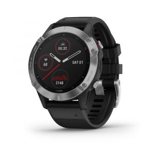
Garmin Fenix 6
Accessories, Garmin, Navigation, Watch / GPS$ 999.00With its always-on 1.3" display, the Fenix 6 boasts an impressive 18% larger screen compared to previous Fenix models, providing crystal-clear visibility in any conditions. This GPS multisport watch is not just a timepiece; it's a reliable companion for your most daring expeditions. Tested to U.S. military standards for thermal, shock, and water resistance, the Fenix 6 is built to endure the harshest environments. Its robust construction ensures unmatched durability, making it the perfect choice for those who demand uncompromising performance from their gear. Unleash your full potential and conquer new frontiers with the Garmin Fenix 6 - where cutting-edge technology meets rugged reliability. Elevate your outdoor pursuits with confidence and precision, only with the unmatched resilience of the Fenix 6. Pro Edition: Enables features on the watch such as Trendline Popularity Routing, PacePro, ski maps and the ability to preload music. Sapphire Edition: Pro Edition features, plus a scratch-resistant sapphire lens. Solar Edition: Versions with Power Glass lenses that harvest solar energy.Experience the ultimate in outdoor adventure with the Garmin Fenix 6.
Features:
SPORTS APPS Use preloaded activity profiles for trail running, swimming, running, biking, hiking, rowing, skiing, golfing and more. POWER MANAGER View how various settings and sensors impact your watch's battery life, so you can make battery-extending changes on the fly. WRIST-BASED HEART RATE The watch constantly samples your heart rate1 and will alert you if it stays too high or too low while you're at rest. It also helps gauge how hard you work during activities. Even underwater. BODY BATTERY ENERGY MONITOR Optimise your body's energy reserves, using heart rate variability, stress, sleep and other data to gauge when you're ready to be active or when you may need to rest. PERFORMANCE METRICS View advanced training metrics that include running dynamics, heat- and altitude-adjusted VO2 max, recovery advisor and more. BATTERY LIFE Internal, rechargeable lithium battery provides up to 14 days of battery life in smartwatch mode, 36 hours in GPS mode and up to 48 days in battery saver mode. Case Size: 47mm For full features and specifications, please visit Garmin's Website. -
Sold out

Garmin Fenix 6S
Accessories, Garmin, Navigation, Watch / GPS$ 1,149.00 – $ 1,299.00For durability in any environment, fenix 6S is tested to U.S. military standards for thermal, shock and water resistance.Pro Edition: Enables features on the watch such as Trendline Popularity Routing, PacePro, ski maps and the ability to preload music. Sapphire Edition: Pro Edition features, plus a scratch-resistant sapphire lens. Solar Edition: Versions with Power Glass lenses that harvest solar energy. --------- SPORTS APPS Use preloaded activity profiles for trail running, swimming, running, biking, hiking, rowing, skiing, golfing and more. POWER MANAGER View how various settings and sensors impact your watch's battery life, so you can make battery-extending changes on the fly. WRIST-BASED HEART RATE The watch constantly samples your heart rate1 and will alert you if it stays too high or too low while you're at rest. It also helps gauge how hard you work during activities. Even underwater. BODY BATTERY ENERGY MONITOR Optimise your body's energy reserves, using heart rate variability, stress, sleep and other data to gauge when you're ready to be active or when you may need to rest. PERFORMANCE METRICS View advanced training metrics that include running dynamics, heat- and altitude-adjusted VO2 max, recovery advisor and more. BATTERY LIFE Internal, rechargeable lithium battery provides up to 9 days of battery life in smartwatch mode, 25 hours in GPS mode and up to 34 days in battery saver mode. Case Size: 42mm For full features and specifications, please visit Garmin's Website. -
Sold out
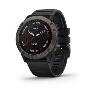
Garmin Fenix 6X
Accessories, Garmin, Navigation, Watch / GPS$ 1,649.00Ships within 3-5 daysPush new limits and explore new challenges — while adding mapping, music, intelligent pace planning and more to your workouts with the fēnix 6X selection of premium smartwatches.The rugged yet sophisticated design features a large 1.4” display that’s 36% larger than previous fēnix models. It is tested to U.S. military standards for thermal, shock and water resistance. Fit the look to your lifestyle with your choice of stainless steel or DLC coated bezels. Each Sapphire edition adds a scratch-resistant sapphire lens and premium materials. Pro Edition: Enables features on the watch such as Trendline Popularity Routing, PacePro, ski maps and the ability to preload music. Sapphire Edition: Pro Edition features, plus a scratch-resistant sapphire lens. Solar Edition: Versions with Power™ Glass lenses that harvest solar energy. --------- Features: - Wrist-based heart rate and Pulse Ox sensors add insight to your fitness activities - Dynamic PacePro™ feature helps you run smarter over various types of terrain - Preloaded ski maps for 2,000 resorts around the world - Measure running and cycling performance in ways you didn't know were possible - Sync your favourite streaming services and listen to music without your phone - Don’t be limited by battery life. Go up to 21 days between charges in smartwatch mode Case size: 51mm For full features and specifications, please visit Garmin's Website. -
Sold out
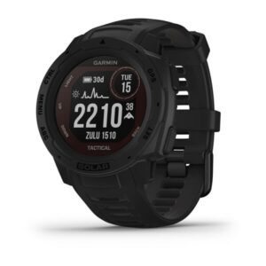
Garmin Instinct Solar
Accessories, Garmin, Navigation, Watch / GPS$ 799.00Built for the mission and designed for endurance, the Garmin Instinct Solar is equipped to keep up with your every step, no matter how far you tread. Harnessing the power of solar energy, this innovative GPS watch ensures that you never miss a beat during your outdoor pursuits. With robust durability and advanced features tailored to meet the demands of explorers and outdoor enthusiasts, the Garmin Instinct Solar is much more than just a timepiece – it's a vital companion for your most ambitious undertakings. Crafted with precision engineering and rugged sophistication, the Garmin Instinct Solar excels in providing essential navigation tools, health monitoring features, and superior battery life. Whether you're navigating challenging terrain or tracking your fitness metrics in remote locations, this exceptional watch stands ready to empower your adventures with reliable GPS functionality powered by solar technology.Introducing the Garmin Instinct Solar, a cutting-edge GPS watch designed for those who forge their own paths and embrace the spirit of adventure.
Features:
- Experience unprecedented battery life with solar charging. - Military standard toughness lets you play rough without worry. - GPS, GLONASS and Galileo. Your 3 best friends in the wild. - Train smarter with built-in sports apps right on your wrist. - Get notifications straight from your phone to your wrist. - Do more. Charge less. Get up to 54 days in smartwatch mode. Solar Battery: Variable based on sun-exposure, Instinct can provide unprecedented battery life to those that explore under the sun. Military Standard 810:Instinct is built to the U.S. military standard 810 for thermal, shock and water resistance (rated to 100 metres). Power Manager: View how various settings and sensors impact your watch?s battery life, so you can make battery-extending changes on the fly. Specs:LENS MATERIAL Power Glass? BEZEL MATERIAL Fibre-reinforced polymer CASE MATERIAL Fibre-reinforced polymer QUICKFIT? WATCH BAND COMPATIBLE Yes (22 mm) STRAP MATERIAL Silicone PHYSICAL SIZE 45 x 45 x 15.3 mm Fits wrists with a circumference of 132-224 mm DISPLAY SIZE Custom, two-window design; 0.9? x 0.9? (23 x 23 mm) DISPLAY RESOLUTION 128 x 128 pixels DISPLAY TYPE "Monochrome, sunlight-visible, transflective memory-in-pixel (MIP) WEIGHT 53 g BATTERY LIFE Smartwatch: Up to 24 days/54 days with solar* Battery Saver Watch Mode: Up to 56 days/Unlimited with solar* GPS: Up to 30 hours/38 hours with solar** Max Battery GPS Mode: Up to 70 hours/145 hours with solar** Expedition GPS Activity: Up to 28 days/ 68 days with solar* "*Solar charging, assuming all-day wear with 3 hours per day outside in 50000 lux conditions "**Solar charging, assuming use in 50,000 lux conditions WATER RATING 10 ATM MEMORY/HISTORY 16 MB -
Sold out

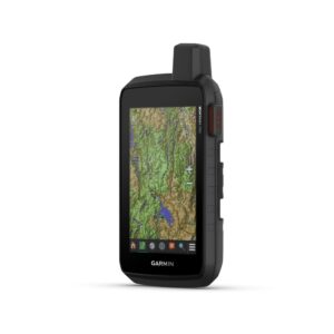
Garmin Montana 700
Accessories, Garmin, Navigation, Watch / GPS$ 999.00Explore your world with navigation you trust.With routable mapping for roads and trails, the Montana 700 handheld brings advanced outdoor features into a sturdy 5 format that's ideal for navigation on foot, bike, kayak, ATV and more. RUGGED BY DESIGN This durable, water-resistant handheld is tested to U.S. military standards and features a glove-friendly 5" touchscreen that's 50% larger than previous Montana models TOPOACTIVE AUSTRALIA AND NEW ZEALAND MAPS To navigate your adventures, use preloaded TopoActive Australia and New Zealand maps. View elevations, coastlines, rivers, landmarks and more. SATELLITE VIEWS Use direct-to-device downloads of BirdsEye Satellite Imagery (no annual subscription required) to see photo-realistic views and create waypoints based on landmarks. ABC SENSORS Navigate your next trail with ABC sensors, including an altimeter for elevation data, barometer to monitor weather and 3-axis electronic compass. ACTIVE WEATHER Use cellular connectivity to access up-to-date Active Weather forecasts through the Garmin Connect app. DOG TRACKING For hunters and trainers, this Montana syncs with compatible Astro or Alpha series handhelds (sold separately) to help track sporting dogs in the field. MULTI-GNSS SUPPORT Access to GPS, GLONASS and GALILEO satellite networks enables Montana 700 to track in more challenging environments than GPS alone. LOCATION SHARING The LiveTrack feature lets you wirelessly connect1 your device with other compatible Garmin GPS users, so they can follow your tracks, routes, waypoints and adventures. EXPEDITION MODE Trek far and wide off-grid. Use Expedition mode, an ultralow-power GPS reference, to keep Montana tracking for a week or more between recharges. BATTERY OPTIONS An internal, rechargeable lithium-ion battery pack provides more than 18 hours of battery life in GPS mode. It can also be powered with traditional AA batteries. VEHICLE MOUNTS A variety of Montana handheld-compatible mounts (sold separately) lets you adapt your navigator for use on ATVs, boats, cars, motorcycles, RVs or other vehicles. -
Sold out
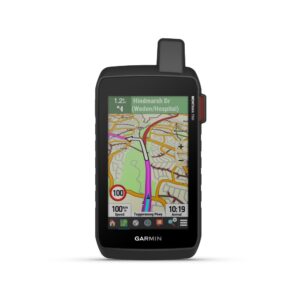
Garmin Montana 700i
Garmin, Navigation, Watch / GPS$ 1,199.00GO INTO THE WILD WITH A SATELLITE CONNECTIONTo keep adventurers in touch and on track, the Montana 700i handheld combines the flexibility of on- or off-road navigation with global messaging and interactive SOS via inReach satellite technology1. Big news. A full QWERTY keyboard lets you easily type messages. Wander wider and still stay in touch—with inReach for messaging and 24/7 SOS. Routable TopoActive Australia and New Zealand maps. Now you're free to take it off-road or on. Meets MIL-STD 810 for thermal, shock, water and vibration. Get the clear perspective of BirdsEye Satellite Imagery right to your device. Power your adventures with 18+ hours of lithium-ion battery life in GPS mode. TWO-WAY MESSAGING Exchange text messages with loved ones, post to social media, or communicate via inReach device to inReach device in the field (active satellite subscription required). INTERACTIVE SOS In case of emergency, trigger an interactive SOS message to GEOS, a professional 24/7 global monitoring and response centre (active satellite subscription required). GLOBAL CONNECTIVITY Instead of relying on cellphone coverage, now your messages, SOS and tracking are transferred via the 100% global Iridium satellite network (active satellite subscription required). INREACH WEATHER Available inReach weather forecast service provides detailed updates directly to your Montana handheld or paired devices, so you'll know what to expect en route. RUGGED BY DESIGN This durable, water-resistant handheld is tested to U.S. military standards and features a glove-friendly 5" touchscreen that's 50% larger than previous Montana models. CITY NAVIGATOR MAPS Seamlessly transition from trails to road navigation with preloaded City Navigator street mapping, which guides your drive with easy-to-follow turn-by-turn directions. TOPOACTIVE AUSTRALIA AND NEW ZEALAND MAPS To navigate your adventures, use preloaded TopoActive Australia and New Zealand maps. View elevations, coastlines, rivers, landmarks and more. SATELLITE VIEWS Use direct-to-device downloads of BirdsEye Satellite Imagery (no annual subscription required) to see photo-realistic views and create waypoints based on landmarks. ABC SENSORS Navigate your next trail with ABC sensors, including an altimeter for elevation data, barometer to monitor weather and 3-axis electronic compass. ACTIVE WEATHER Use cellular connectivity2 to access up-to-date Active Weather forecasts through the Garmin Connect app. DOG TRACKING For hunters and trainers, this Montana syncs with compatible Astro or Alpha series handhelds (sold separately) to help track sporting dogs in the field. MULTI-GNSS SUPPORT Access to GPS, GLONASS and GALILEO satellite networks enables Montana 700i to track in more challenging environments than GPS alone. TRACKING Track your location, and share it with those at home or out in the field. They'll be able to see your progress or ping your device for your GPS location and more via your web-based MapShare trip-sharing page. (Montana 700i, 750i only - satellite subscription required). EXPEDITION MODE Trek far and wide off-grid. Use Expedition mode, an ultralow-power GPS reference, to keep Montana tracking for a week or more between recharges. EXTENDED BATTERY LIFE An internal, rechargeable lithium-ion battery pack provides more than 18 hours of battery life in GPS mode. VEHICLE MOUNTS A variety of Montana handheld-compatible mounts (sold separately) lets you adapt your navigator for use on ATVs, boats, cars, motorcycles, RVs or other vehicles. -
Sold out
Garmin Montona 750i
Accessories, Garmin, Navigation, Watch / GPS$ 1,349.00SEE THE WORLD. STAY IN TOUCH. BE THE PICTURE OF ADVENTURE.The rugged Montana 750i handheld combines the flexibility of on- or off-road navigation with global messaging and interactive SOS via inReach satellite technology—plus a built-in 8-megapixel camera. Big news. A full QWERTY keyboard lets you easily type messages. Wander wider and still stay in touch with inReach for messaging and 24/7 SOS. Nav, meet cam. Put your trip pics on the map with geotags. Routable TopoActive Australia and New Zealand maps. Now you're free to take it off-road or on. Meets MIL-STD 810 for thermal, shock, water and vibration. Power your adventures with 18+ hours of lithium-ion battery life in GPS mode. TWO-WAY MESSAGING Exchange text messages with loved ones, post to social media, or communicate via inReach device to inReach device in the field (active satellite subscription required) INTERACTIVE SOS In case of emergency, trigger an interactive SOS message to GEOS, a professional 24/7 global monitoring and response centre (active satellite subscription required). GLOBAL CONNECTIVITY Instead of relying on cellphone coverage, now your messages, SOS and tracking are transferred via the 100% global Iridium satellite network (active satellite subscription required). INREACH WEATHER Available inReach weather forecast service provides detailed updates directly to your Montana handheld or paired devices, so you'll know what to expect en route. RUGGED BY DESIGN This durable, water-resistant handheld is tested to U.S. military standards and features a glove-friendly 5" touchscreen that's 50% larger than previous Montana models. BUILT-IN CAMERA Capture images of your exploits with Montana's digital 8-megapixel camera. It geotags photos with coordinates, so you can navigate back to favourite sites in the future. CITY NAVIGATOR MAPS Seamlessly transition from trails to road navigation with preloaded City Navigator street mapping, which guides your drive with easy-to-follow turn-by-turn directions. TOPOACTIVE AUSTRALIA AND NEW ZEALAND MAPS To navigate your adventures, use preloaded TopoActive Australia and New Zealand maps. View elevations, coastlines, rivers, landmarks and more. SATELLITE VIEWS Use direct-to-device downloads of BirdsEye Satellite Imagery (no annual subscription required) to see photo-realistic views and create waypoints based on landmarks. ABC SENSORS Navigate your next trail with ABC sensors, including an altimeter for elevation data, barometer to monitor weather and 3-axis electronic compass. ACTIVE WEATHER Use cellular connectivity2 to access up-to-date Active Weather forecasts through the Garmin Connect app. DOG TRACKING For hunters and trainers, this Montana syncs with compatible Astro or Alpha series handhelds (sold separately) to help track sporting dogs in the field. MULTI-GNSS SUPPORT Access to GPS, GLONASS and GALILEO satellite networks enables Montana 750i to track in more challenging environments than GPS alone. TRACKING Track your location, and share it with those at home or out in the field. They'll be able to see your progress or ping your device for your GPS location and more via your web-based MapShare trip-sharing page. (Montana 700i, 750i only - satellite subscription required). EXPEDITION MODE Trek far and wide off-grid. Use Expedition mode, an ultralow-power GPS reference, to keep Montana tracking for a week or more between recharges. EXTENDED BATTERY LIFE An internal, rechargeable lithium-ion battery pack provides more than 18 hours of battery life in GPS mode. VEHICLE MOUNTS A variety of Montana handheld-compatible mounts (sold separately) lets you adapt your navigator for use on ATVs, boats, cars, motorcycles, RVs or other vehicles. -
Sold out

Hunters Specialties 3 Colour Speed Camo Tri Colour Makeup Kit
Accessories, Eyewear, Headwear, Hunters Specialties, Miscellaneous, Navigation$ 19.95Speed Camo allows hunters to use three individual camo sticks at once to create custom patterns, and with the Speed Camo applicator, up to two inches of coverage can be applied with one swipe. Colors include forest green, mud brown, and flat black. Speed Camo makeup is easily removed with Hunters Specialties’ handy Camo-Off® makeup remover pads, or with soap and water.Quickly apply three camo colors with one convenient pocket-sized applicator.
Features
- 3 colours - Convenient pocket-sized case - No discomfort, drying or cracking - Won't run and removes easily - Colours: Forest Green, Mud Brown, and Flat Black. - Made in U.S.A -
Sold out
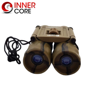
Innercore 10×25 Camo Binoculars
Accessories, Categories, Innercore, Miscellaneous, Navigation$ 29.95It also comes with a nylon carry pouch with belt loop and a lens cloth. - 10x Magnification - 25mm Objective Lens - Camouflage Colouring - Roof Prism - Aluminum Tube - Rubber Armour - Prism Type: BAK7 - Centre Focus - Includes Nylon Pouch with Belt Loop and Lens ClothInnercore 10x25 Binoculars are folding roof prism binoculars with 10x magnification and a 25mm objective lens.
Navigation