
-
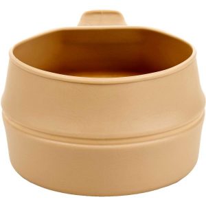
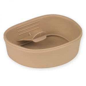
Wildo Fold-A-Cup-Big
Food & Hydration, Plates & Bowls, Utensils, Wildo$ 13.95Let’s make a great product even greater! The Fold-A-Cup® Big is designed to fit The Original Fold-A-Cup® in its center even when its folded.The Fold-A-Cup® Big pops open from it’s folded position to form a cup or bowl. It can hold up to 600 ml liquid but is just 4 cm when folded. The fold also ensures that it won’t drip after emptied. The Fold-A-Cup® Big is BPA-free. Specifications: Volume: 600 ml/ 20 fl. oz Weight: 46 g/1.6 oz Size: 12x10.5x4 cm/ 4.5x4 x1.5 in Material: TPE -
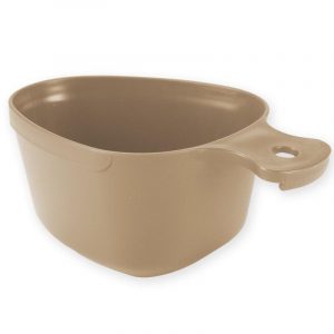
Wildo Kasa Army Cup/Mug
Food & Hydration, Plates & Bowls, Utensils, Wildo$ 4.25 – $ 4.75The pear-shaped form gives a nice grip that makes it easy to hold. The Kåsa Army is enjoyed by many outdoor enthusiasts to both eat and drink from. The Kåsa Army can be stacked together for minimal space consumption.The Kåsa Army is inspired by the classic Swedish army mug.
FEATURES:
- Ideal for food or drink - Lanyard / Hanging Hole - BPA-Free - Volume: 295ml - Weight: 49g - Size (including handle): 15.5 x 9.9 x 6cm - Dishwasher Safe - Made in Sweden -

Wildo Kasa Bowl
Food & Hydration, Plates & Bowls, Wildo$ 6.95Its simplicity is its strength. A multitasking bowl, perfect to eat and drink from. The Kåsa Bowl can be stacked together for minimal space consumption. The Kåsa Bowl is BPA-Free.The Kåsa Bowl is a timeless mug inspired by the Nordic Sami mug.
SPECIFICATIONS:
- Length: 146mm - Width: 115mm - Height: 46mm, - Volume: 30ml - Weight: 32g -
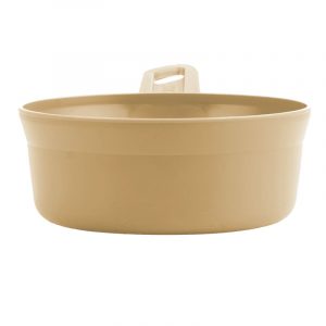
Wildo Kasa Bowl XL
Food & Hydration, Plates & Bowls, Wildo$ 13.95Its shape and size make it universal to both eat and drink from or even use as a scoop. Furthermore, the Kåsa XL is equipped with a hole in the handle that enables it to be attachable to your pack. The Kåsa XL is provided with measuring lines. The Kåsa XL is BPA-Free.The Kåsa XL is the largest kåsa in the Wildo line.
SPECIFICATIONS:
- VOLUME: 30oz (887ml) - WEIGHT: 3oz (80g) - DIMENSIONS: 9 x 2.3in (23 x 6cm) With Handle -
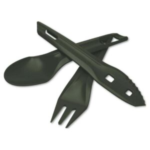
Wildo Ocy Chow Kit
Food & Hydration, Sets, Utensils, Wildo$ 24.95It splits up into a sharp knife, a fork with good grip and an extendable spoon. Perfect when stirring a pot or eating a freeze dried meal.The Ocy's is Wildo's outdoor cutlery set. It stacks as a unit for easy packing and storage.
Specifications
Item Dimensions Approx: 17cm (L)Features
- Made in Sweden - 70% plant based material.Includes:
1x Spoon 1x Knife 1x Fork -
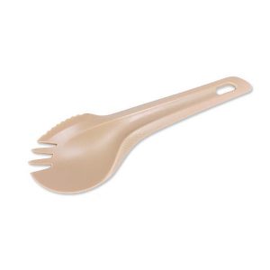
Wildo Spork
Food & Hydration, Utensils, Wildo$ 3.95 – $ 4.95Sip your soup, hook your food, turn 90 degrees and slice with your knife. It's all you need for a meal outdoors. What's more, the Spork fits nicely into the Original Camp-A-Box. The Wildo Spork is BPA free.The Wildo Spork is the ultimate hybrid utensil - you get all your cutlery in one implement with excellent grip.
Specifications:
Weight: 8.5g Size: 16.5 x 4.8 x 1.5cm Material: PP -
Wildo-Fold-A-Cup Original
Food & Hydration, Plates & Bowls, Utensils, Wildo$ 9.95The Fold-A-Cup® pops open from it´s folded position to form a cup or bowl. The Fold-A-Cup® can hold up to 250 ml but is just 2.5 cm when folded. The fold ensures that it won’t drip after emptied. We are proud that The Fold-A-Cup® has been classified as a work of art by Svensk Form Copyright Panel. The Fold-A-Cup® is BPA-free.It started with an idea for the perfect product. Now, more than 35 years later The Original Fold-A-Cup® is a classic, found all around the world. Made to go where ever you go.
Specifications:
Volume: 250 ml/8 fl. oz Weight: 25 g/0.9 oz Size: 9.5x7x2.5 cm/3.5x3x1 in Material: TPE -
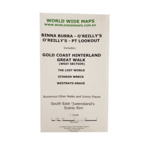
World Wide Maps Binna Burra – O’Reillys Map
Accessories, Navigation, World Wide Maps$ 25.50Map includes all the bush walks and the Great Walk from Binna Burra to O'Reilly's, as well as The Lost World, Stinson Wreck and Westrays Grave. One map does it all. 1:25,000 scale.Topographic map (A1 size) Binna Burra to O'Reilly?s to Point Lookout on the Scenic Rim in the Gold Coast Hinterland.
-
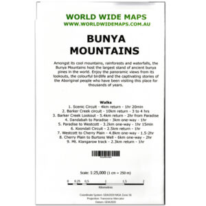
World Wide Maps Bunya Mountains Map
Accessories, Miscellaneous, World Wide Maps$ 25.50This map is printed as a full size topographic map with contours and walking trails and loads of other information. Scale is 1:25,000.Bunya Mountains is a popular bush walking/hiking area north west of Brisbane.
-
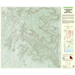
World Wide Maps Carnarvon Gorge Great Walk Map
Accessories, Navigation, World Wide Maps$ 25.50Full size (A1) topographic map at 1:50,000 scale of the entire Carnarvon Great Walk.This is the best traditional topographic map of the Great Walk and the topography of the gorge and tablelands. -

World Wide Maps Cooloola Wilderness Trail & Upper Noosa River
Accessories, Miscellaneous, Notepads & Stationery, World Wide Maps$ 25.50Shows the trail and campsites along the trail as well as campsites along the Upper Noosa River.A1 size topographic map at 1:50,000 scale. Great for bushwalking and the great outdoors activities.
-
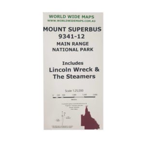
World Wide Maps Count Superbush Bush Walks Map
Accessories, Navigation, World Wide Maps$ 25.50Mount Superbus, the Steamers, the Lincoln Wreck and north to Mount Huntley.This map is a full size A1 topographic map at 1:25,000 standard map number 9341-12. Includes information about some walks and camp sites and how to get there. -
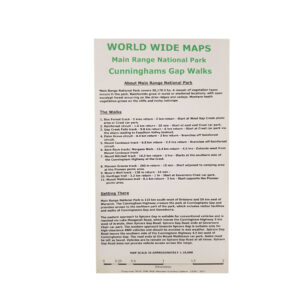
World Wide Maps Cunninghams Gap Bush Walks – Main Range
Accessories, Navigation, World Wide Maps$ 25.50- Box Forest track - Rainforest circuit - Gap Creek Falls track - Palm Grove circuit - Mount Cordeaux track - Bare Rock track/ Morgans Walk - Mount Mitchell track - Pioneer Graves track - Moss's Well track - Heritage trail - Mount Mathieson trail The map comes as compact shirt pocket sized (A3) double sided and folded topographic maps of the Cunninghams Gap–Main Range National Park area. The maps display the best available contours, tracks and the latest topographic information. The reverse side is a general location topo/road map and the map includes general instructions on how to get to the area. The map data is sourced from the latest Queensland Government topographic datasets through QTopo and the Government's Open Data Strategy.1:18,000 scale topographic map of Cunninghams Gap and Main Range bush walking tracks:
-
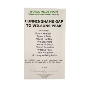
World Wide Maps Cunninghams Gap to Wilsons Peak Map
Accessories, Navigation, World Wide Maps$ 25.50One great topographic map at 1:50,000 scale showing the whole Main Range from Cunninghams Gap to Wilsons Peak.Includes Mount Mitchell, Mount Huntley, The Steamers, Mount Superbus and Lake Moogerah. -

World Wide Maps Girraween Camps & Walks Map
Accessories, Navigation, World Wide Maps$ 25.50Derived from the latest government databases with information about walks, camping and caravan information and links to book your campsite. This map is intended to replace the Hema Girraween map and the government Girraween topo, which are both no longer in production.World Wide Maps have produced a 1:25,000 scale full size topographic map
-
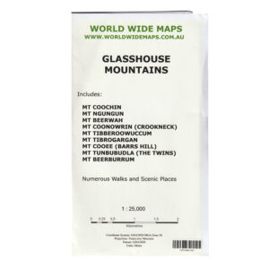
World Wide Maps Glasshouse Mountains Map
Accessories, Miscellaneous, World Wide Maps$ 25.50Topo map of the Glasshouse Mountains in South East Queensland at 1:25,000 scale.
Includes 9 of the famous mountains:
- Mt Coochin - Mt Ngungun - Mt Beerwah - Mt Coonowrin - Mt Tibrogargan - Mt Tibberoowuccum - Mt Cooee - Mt Tunbubudla - Mt Beerburrum -
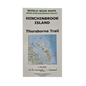
World Wide Maps Hinchinbrookk Island – Thorsborne Trail 1:50000 Scale
Accessories, Navigation, World Wide Maps$ 25.50And covering most of the rest of the island except the North East and North West points. The map has the camping sites and toilets marked and information about the walk, as well as link to national parks website for further information.An A1 size folded paper topographic map at 1:50,000 scale covering the entire Thorsborne Trail on Hinchinbrook Island.
-

World Wide Maps Lost World and Stinson Wreck Map
Accessories, Navigation, World Wide Maps$ 25.501:25,000 scale and full sized topo map for bush walking to both the Stinson Wreck and Lost World and the areas between them.All on one map sheet. -
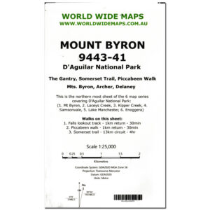
World Wide Maps Mount Byron 9443-41 Map
Accessories, Miscellaneous, World Wide Maps$ 25.50This is the northern most map covering the northern D'Aguilar National ParkStandard Topographic map of Mount Byron 9443-41 north west of Brisbane at a scale of 1:25,000.
-
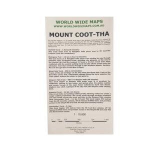
World Wide Maps Mount Coot-Tha Map
Accessories, Navigation, World Wide Maps$ 25.50A full size (A1) topographic map at 1:10,000 scale of Mount Coot-tha Brisbane.Information about the walks and the trails marked. -
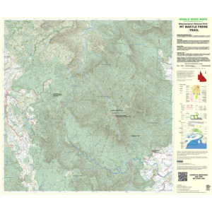
World Wide Maps Mt. Bargle Frere Trail Map
Accessories, Navigation, World Wide MapsA full sized 1:36,000 scale topographic map of Mount Bartle Frere Trail showing the trail, information about the trail and how to get there, camp sites, and all of the normal topographic features. Climb Queensland's highest mountain with the best map for it ever published!$ 25.50 -
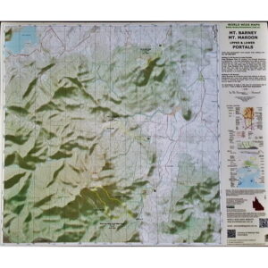
World Wide Maps Mt. Barney Mt. Maroon Upper & Lower Portals Map
Accessories, Navigation, World Wide Maps$ 25.50Key walks marked with short descriptions and advice on how to get there. This is a full sized (A1) 1:25000 scale topographic map with 3 of South East Queensland's most popular walking areas all on one topo map. This is the SEQ bushwalker's must have map! There are numerous walks contained within this topographic map area.Mount Barney, Mount Maroon and Upper and Lower Portals all on one topographic map!
-
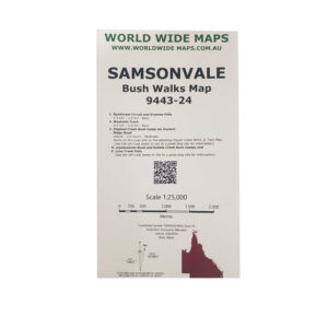
World Wide Maps Samsonvale Bush Walks Map 9443-24
Accessories, Navigation, World Wide Maps$ 25.50This print on demand 1:25,000 scale topo map Samsonvale 9443-24, replaces the old published map (1981).The standard topo map has been enhanced by World Wide Maps with 5 bush walks highlighted. 1. Rainforest Circuit and Greenes Falls 2. Westside Track 3. England Creek Bush Camp via Joyners Ridge Road 4. Lepidozamia Road and Kobble Creek Bush Camps 5. Love Creek Falls The map covers part of South D'aguilar National Park, Brisbane Forest Park. -
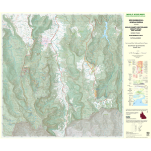
World Wide Maps Springbrook Binna Burra Topographic Map
Accessories, Navigation, World Wide MapsTopographic Map (A1 size) Springbrook to Binna Burra Great Walk—Showing walking tracks including the Great Walk between Springbrook and Binna Burra on the scenic rim in the Gold Coast Hinterland, South East Queensland. 1:25,000 scale.$ 25.50
Shop
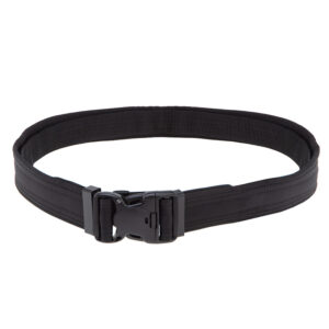
View cart “Valhalla Police Belt” has been added to your cart.